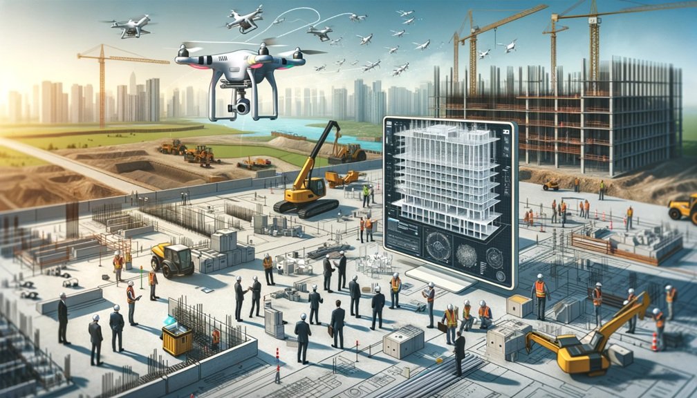
Pairing drones with Building Information Modeling (BIM) is helping construction teams streamline planning, improve communication and reduce costly mistakes. Sonoran Desert Institute (SDI) , accredited by the Distance Education Accrediting Commission (DEAC), helps professionals gain the skills needed to work with these tools effectively. By using drones to feed accurate, real-time data into BIM models, teams can stay aligned, adapt quickly and manage sites more efficiently.
When drones and BIM are used together, teams gain access to more accurate data and clearer project insights. This combination allows for faster adjustments, fewer delays and a more practical approach to day-to-day site management.
How Drones Enhance BIM Workflows
Building Information Modeling relies on accurate, up-to-date data for detailed visualizations and simulations. Drones enhance BIM by capturing high-resolution images, videos and measurements with speed and precision.
- Real-Time Data Collection: Drones provide current site data for seamless BIM integration, enabling teams to monitor progress and address discrepancies promptly.
- Detailed 3D Mapping: Advanced sensors like LiDAR and photogrammetry generate 3D maps that enhance planning and decision-making when overlaid with BIM models.
- Improved Surveying Efficiency: Drones expedite surveying over large areas, reducing time and labor while ensuring BIM models remain updated and accurate.
The Synergy Between Drone-Generated 3D Maps and BIM
The integration of drone-generated 3D maps into BIM workflows creates a powerful synergy that enhances project planning and execution. This combination allows construction teams to visualize and analyze site data in ways that were previously impossible.
Enhanced Visualization:
Drone-generated 3D maps provide detailed, high-resolution visuals that can be directly integrated into BIM models. This integration enables stakeholders to view the project in its entirety, from the design phase to construction progress. Aligning drone data with BIM models ensures that any deviations from the original plans are quickly identified and addressed.
Accurate Clash Detection:
Combining drone data with BIM helps identify potential conflicts or clashes between design elements and on-site conditions. For instance, drone-generated maps can reveal obstacles or discrepancies in terrain that might interfere with planned construction activities. Detecting these issues early reduces rework and keeps the project on schedule.
Streamlined Planning and Simulation:
Drone data provides precise measurements and geospatial information that can be used to refine construction plans within BIM. This capability is particularly useful for projects with challenging site conditions, where accurate terrain data is critical for planning foundations, drainage systems or utility placement.
Benefits of Integrating Drones with BIM
Integrating drone technology with BIM helps teams work more efficiently and make smarter decisions at every stage of construction. It supports better planning, minimizes costly mistakes and keeps everyone working from the same up-to-date information.
Reduced Errors and Rework
By providing real-time updates and high-resolution data, drones help ensure that BIM models accurately reflect site conditions. This accuracy minimizes the risk of errors and reduces costly rework caused by outdated or inaccurate information.
Enhanced Collaboration
Drone-generated data shared through BIM platforms fosters better communication and collaboration among stakeholders. Project managers, architects, engineers and contractors can access the same up-to-date information, ensuring everyone is on the same page and aligned with project goals.
Improved Safety
Drones allow for safer site assessments by eliminating the need for personnel to physically access hazardous areas. By capturing data remotely, drones reduce the risk of accidents during surveying or inspections.
Cost and Time Savings
Drones’ speed and efficiency significantly reduce the time required for surveying and progress monitoring. Combined with BIM, this efficiency translates to faster project timelines and lower overall costs.
Optimized Resource Allocation
By integrating drone data into BIM, project managers can better allocate resources based on accurate site information. This optimization prevents delays caused by misallocated equipment or workforce.
Real-World Applications of Drones and BIM Integration
The practical applications of integrating drones with BIM extend across various types of construction projects, including infrastructure, residential and commercial developments. For example:
- Site Assessments: Drone-generated 3D maps provide detailed terrain data that can be incorporated into BIM models during the pre-construction phase. This ensures accurate planning for earthworks and foundation placement.
- Progress Tracking: Regular drone flights capture data that updates BIM models with real-time progress, allowing project managers to verify that construction is proceeding according to plan.
- Asset Management: Post-construction, drone data integrated with BIM can help maintain accurate records of infrastructure and building components, streamlining future maintenance and renovations.
Streamlined Coordination Between Teams
One of the standout advantages of integrating drones with BIM is the improvement in coordination between teams. Construction projects often involve multiple stakeholders, including architects, engineers, contractors and clients. Ensuring that all parties are aligned can be challenging, especially on large or complex projects.
Drone-generated data simplifies this process by providing a single source of truth that all teams can access through BIM platforms. This centralized approach eliminates confusion, reduces communication gaps and ensures that everyone works with the same accurate and up-to-date information. As a result, teams can collaborate more effectively, make informed decisions and avoid delays caused by miscommunication or outdated data.
The Future of Drone and BIM Integration
As technology advances, the integration of drones and BIM is poised to become even more sophisticated. Artificial Intelligence (AI) and machine learning are already enhancing drones’ capabilities, enabling them to analyze data in real-time and provide actionable insights. For example, AI-powered drones can detect structural issues or track progress deviations automatically, providing instant feedback to BIM models.
Advancements in cloud computing are making it easier to store, process and share large datasets generated by drones. This accessibility ensures that even small construction firms can leverage the benefits of drone and BIM integration without significant upfront investment. Sonoran Desert Institute plays a vital role in equipping professionals with the skills and knowledge needed to navigate these technological advancements, preparing them to lead the way in smarter construction management.
A Smarter Future for Construction Teams
As drone and BIM technologies continue to advance, construction teams have more opportunities to streamline their workflows and avoid costly mistakes. This integration supports better planning, clearer communication and more accurate decision-making across every stage of a project.
When paired effectively, drone data and BIM models provide a shared view that helps teams stay aligned, reduce delays and meet client expectations. From pre-construction planning to final handoff, this combination creates more efficient, informed and responsive site management.
With tools like these becoming more accessible across the industry, teams that embrace them are better equipped to manage challenges, adapt quickly and deliver strong results on every job.


Leave a Reply